
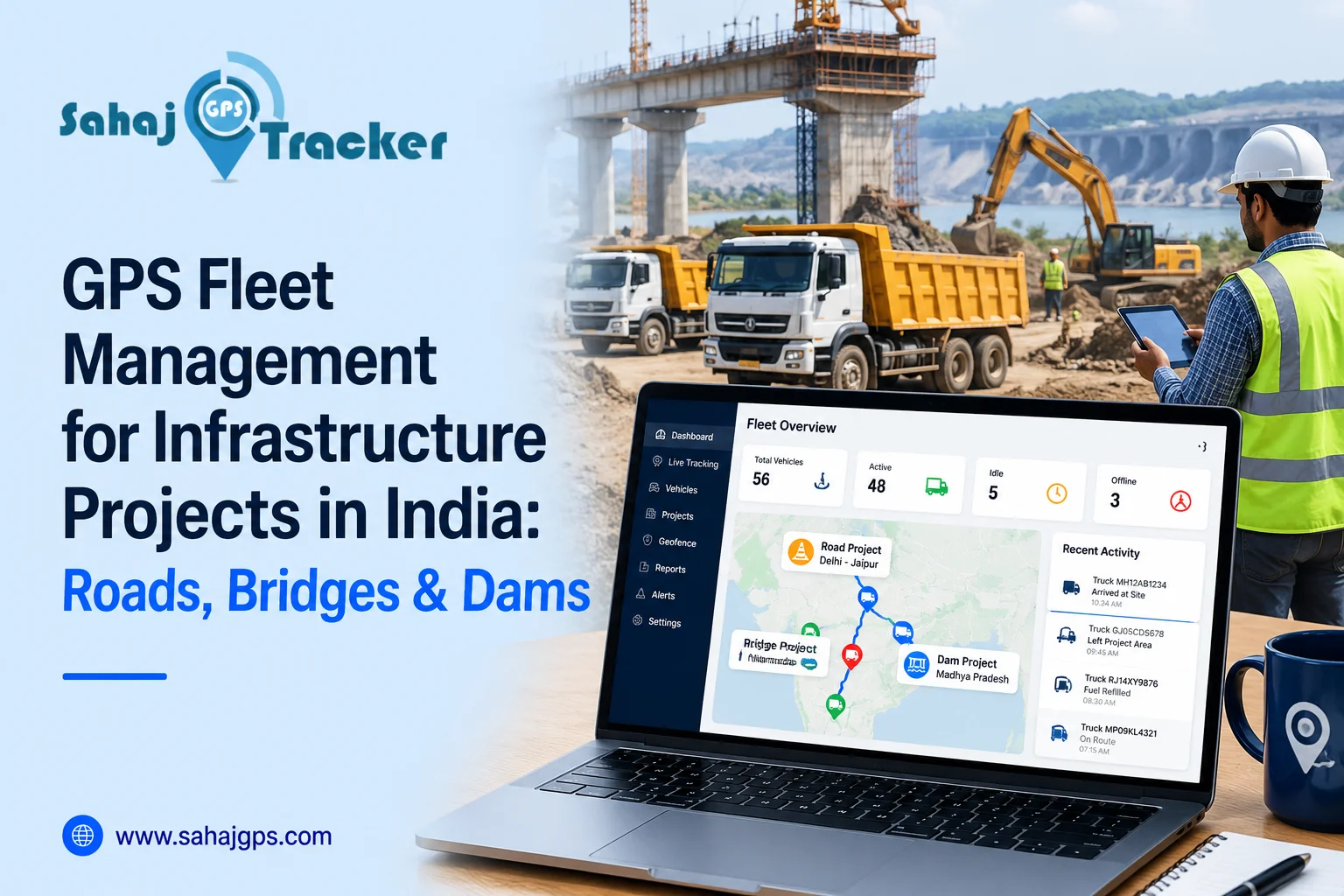
Large infrastructure projects rarely happen in one neat, predictable place. A road project may stretch for kilometres, a bridge site can sit far from the main office, and dam construction often involves rough terrain where regular communication is not always easy. This is where GPS fleet management for Infrastructure Projects in India becomes genuinely useful. With real-time fleet tracking, project teams can keep an eye on trucks, excavators, water tankers, loaders and other vehicles without relying on constant phone calls.
And when dozens of vehicles are moving between material yards, construction sites and temporary project offices, that visibility matters. A lot.
Why GPS Fleet Management Matters for Infrastructure Projects
Infrastructure work involves a constant movement of people, machinery and materials. Aggregate needs to reach the road site. Concrete has to arrive on schedule. Excavated material needs to be moved away. Fuel tankers have to reach equipment operating in remote areas.
One delayed vehicle can sometimes affect several activities behind it. A GPS tracking for infrastructure projects solution helps project managers understand where vehicles are, how they are moving and whether they are following planned routes. Instead of waiting for a driver to call, the operations team can check the tracking dashboard and get a clearer picture. This becomes even more useful when several project sites are running at the same time.
Real-Time Fleet Tracking for Construction Vehicles
Real-time fleet tracking gives infrastructure companies continuous visibility into vehicle movement. Depending on the tracking platform, managers can monitor current location, speed, stoppages, trip history and other vehicle information.
Think about a highway project with 30 tipper trucks moving between a quarry and the construction site. If three trucks are unexpectedly stationary for a long period, the manager can identify the issue much sooner.
Maybe there is traffic. Maybe the loading point is crowded. Or perhaps one vehicle has a mechanical problem.
The GPS data doesn’t answer every question by itself, but it gives the team a useful starting point.
GPS Tracking for Roads, Bridges and Dam Projects
Different infrastructure projects have different vehicle requirements. Road construction may involve dump trucks, rollers, tankers and excavators. Bridge projects can involve cranes, concrete mixers and heavy transport vehicles. Dam construction may require earthmoving equipment, water tankers and material carriers.
A single construction fleet management system can help bring these vehicle movements into one operational view.
GPS Tracking for Road Construction
Road projects often cover long distances, with vehicles travelling between several locations throughout the day. GPS tracking for road construction can help managers monitor material transport, vehicle routes and site arrivals.
Route history can also reveal repeated delays or unnecessary detours. Over several weeks, those small inefficiencies can become surprisingly expensive.
Vehicle Tracking for Bridge and Dam Construction
Bridge and dam projects can involve difficult terrain and restricted access roads. Vehicle tracking for infrastructure companies helps managers maintain better visibility when vehicles are operating away from the main office.
For example, if a heavy equipment carrier is expected at a remote work zone but hasn’t arrived, the project team can check its last recorded location rather than immediately starting a chain of phone calls.
That sounds like a small convenience. On a busy project, it isn’t.
GPS Geo-Fencing for Infrastructure Sites
Construction sites have boundaries for a reason. Some areas may be designated for material loading, equipment storage or worker access, while other zones may be restricted.
GPS geo fencing allows project managers to create virtual boundaries around selected areas. When a tracked vehicle enters or leaves a defined zone, the system can generate an alert.
This can be useful for large infrastructure projects where vehicles move between multiple locations.
Monitor Site Entry and Exit
A geofence can be created around a construction site, warehouse, quarry or material yard. When a vehicle enters the area, the project team can receive an alert. The same can happen when it leaves.
This makes it easier to monitor vehicle visits and understand how long vehicles remain at different locations.
Geofencing can also help identify movement outside designated areas. It doesn’t necessarily explain why the vehicle moved, but it highlights something worth checking.
Route Optimisation Software for Project Vehicles
Infrastructure projects can involve repetitive journeys. A truck might travel from a material supplier to the project site several times a day.
If the route is poorly planned, fuel consumption and travel time can creep upwards. Route optimization software can help businesses review vehicle journeys and plan more efficient routes based on operational requirements. GPS tracking data can provide useful information about previous routes, common stops and travel patterns.
Reduce Unnecessary Travel
Suppose a fleet of 20 trucks is making the same material delivery every day. If several vehicles regularly take longer routes, the project manager can review the journey data and look for alternatives.
There may be road restrictions, traffic or site-specific reasons for the longer route. That’s why the data needs to be interpreted alongside actual project conditions.
Still, having the information is better than guessing.
Expense Tracking Software for Better Project Control
Vehicle movement is closely connected with project expenses. Fuel, tolls, maintenance, driver costs and transportation expenses can quickly add up on large construction projects.
Expense tracking software can help businesses organise operational spending and connect vehicle-related expenses with project activities.
When GPS data is available alongside expense information, managers can get a better understanding of how vehicles are being used.
Connect Vehicle Activity With Operating Costs
For example, if one truck is travelling significantly more kilometres than similar vehicles, its fuel and maintenance expenses may also be higher.
That doesn’t automatically mean there is a problem. The truck may simply be assigned to a more demanding route. But this kind of comparison gives project managers useful information when reviewing costs.
Improve Heavy Equipment Utilisation
Buying and maintaining heavy machinery is expensive. Keeping equipment idle for long periods isn’t ideal either.
GPS tracking can help businesses understand where equipment is located and how often it is being moved between project zones. This can support better equipment allocation and planning. Sahaj GPS provides tracking solutions that can help infrastructure businesses monitor vehicles and mobile assets across different project locations.
Monitor Construction Equipment Movement
Excavators, loaders, cranes and other machinery may need to move between work zones as project stages change. Tracking their movement can help teams maintain better visibility over equipment locations.
For companies working across several sites, this can reduce the time spent searching for a particular vehicle or machine.
GPS Fleet Management for Businesses Across India
Infrastructure projects in India can operate in very different environments. A highway project near a busy city has different challenges from a dam project in a remote region. Connectivity, terrain, traffic and site access can all affect operations.
That is why fleet management systems need to be practical and scalable. Sahaj GPS can support businesses that need centralised visibility across multiple vehicles, project sites and operating zones. Tracking information can help managers coordinate transport activities, review vehicle movement and respond to operational issues more quickly.
For larger contractors, having one fleet dashboard can also make communication between site teams and central operations simpler.
Key Features to Look For in Infrastructure Fleet Tracking
Before choosing a system, infrastructure companies should consider how the technology will fit into their actual workflow.
Useful features may include real-time location tracking, route history, GPS geo-fencing, speed alerts, trip reports, mobile access, vehicle activity monitoring and integration with fuel or expense systems.
Scalability is important too. A contractor may start with 20 vehicles and eventually manage 100 or more. The tracking platform should be able to grow with the project portfolio.
Sahaj GPS offers GPS-based fleet monitoring solutions that can help organisations bring vehicle visibility, route monitoring and site-based alerts into a more organised workflow.
The point isn’t to collect data for the sake of collecting data. The useful part is knowing which information can actually help the project team make a better call.
FAQs
1. How does GPS fleet management help infrastructure projects?
GPS fleet management provides visibility into vehicle locations, routes, stops and movement. It can help project teams coordinate transport, monitor site arrivals and identify delays or unusual vehicle activity.
2. Can GPS tracking be used for road construction vehicles?
Yes. GPS tracking can be used for trucks, tankers, loaders and other construction vehicles. Managers can monitor locations, review routes, check trip history and improve coordination between material suppliers and work sites.
3. What is GPS geo-fencing in construction?
GPS geo-fencing creates virtual boundaries around locations such as construction sites, warehouses, quarries or restricted zones. Alerts can notify managers when tracked vehicles enter or leave these predefined areas.
4. Can GPS tracking help reduce infrastructure project expenses?
It can provide useful data about vehicle kilometres, routes, idling and utilisation. When combined with fuel and expense records, this information can help managers identify areas where unnecessary operating costs may exist.
5. Is fleet tracking useful for remote dam projects?
Yes. GPS tracking can provide better visibility of vehicles and equipment working across large or remote project areas. Route history, location updates and geofencing can make coordination easier for site and central teams.