
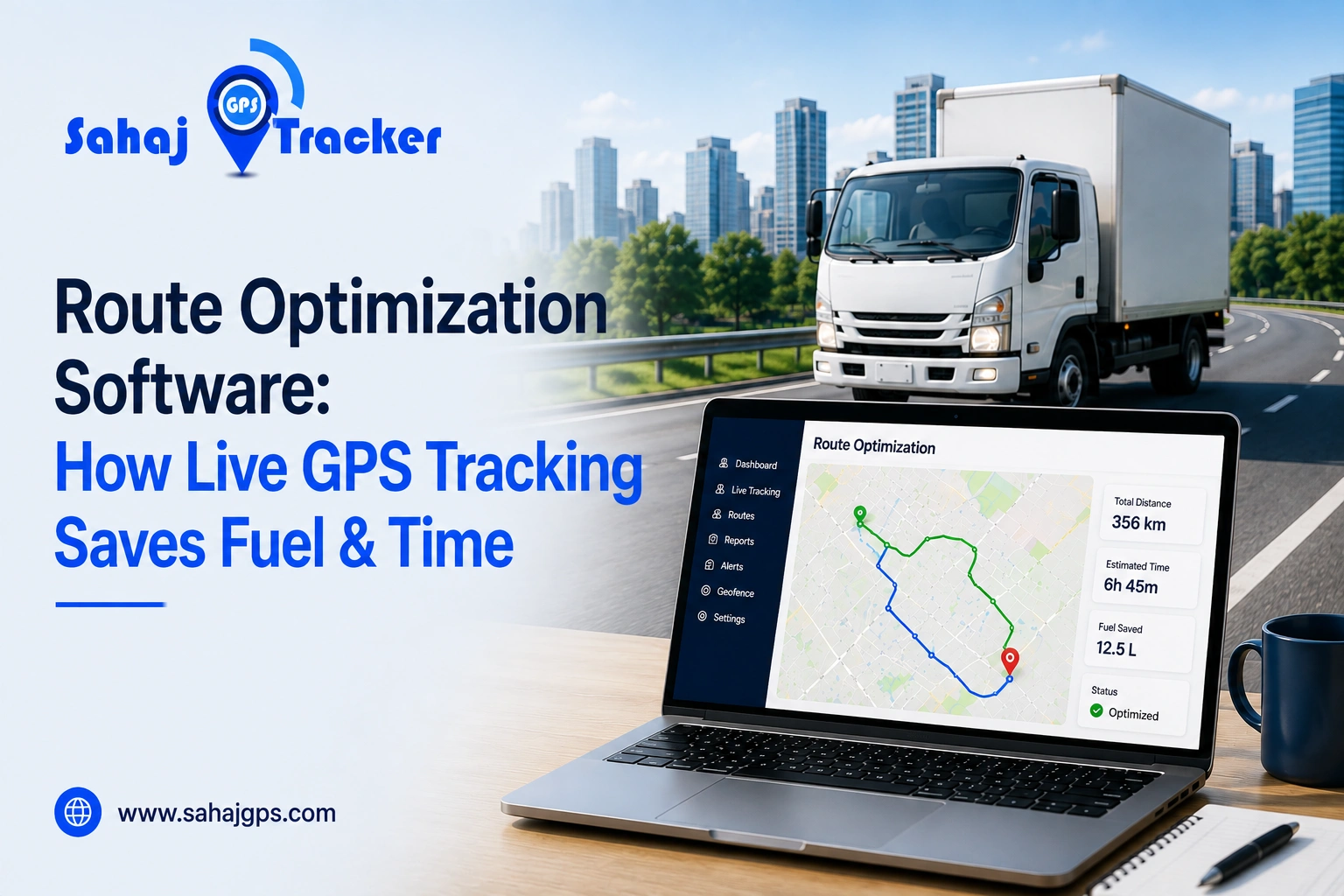
Running a fleet is rarely as simple as giving a driver a list of addresses and sending them on their way. A delivery van may have 15 stops, a service vehicle may need to visit customers across the city, and then there is traffic, road work, parking and last-minute orders. It adds up quickly. This is where route optimization software can help. By combining smart route planning with live GPS tracking, businesses can reduce unnecessary driving, save fuel and give drivers more time to focus on deliveries and service calls.
What Is Route Optimization Software?
Route optimization software helps businesses create more efficient routes for their vehicles. Instead of simply finding the shortest distance between two points, a good route optimization system can consider practical factors such as the number of stops, vehicle capacity, delivery priorities and estimated travel time.
For example, a distributor with 30 customer deliveries may have several shops located in the same area, but if the stops are arranged randomly, the driver could end up crossing the same roads repeatedly.
A route planning system can organise those stops in a more sensible sequence. The goal isn’t always to find the shortest route; it is to find a route that works better for the complete trip.
Sahaj GPS provides vehicle tracking capabilities that can help businesses monitor vehicle movement while using location information to improve fleet visibility and route management.
Why Route Planning Alone Isn’t Enough
Traditional route planing usually happens before a vehicle leaves the warehouse or office. A manager prepares the route, the driver receives the instructions and the trip begins. But real roads don’t always cooperate with the plan. A vehicle may encounter heavy traffic shortly after leaving the depot, a road could be closed temporarily, or a customer may suddenly request an urgent delivery.
This is why live GPS tracking becomes important. It shows what is actually happening on the road rather than what was expected to happen when the route was created. When route planning and real-time vehicle information work together, fleet managers can make better decisions throughout the day instead of discovering problems after the vehicle has already fallen behind schedule.
How GPS Route Optimization Saves Fuel
Fuel is one of those fleet expenses that can quietly become a major cost. A few extra kilometres on one trip may not look significant, but when the same thing happens across dozens of vehicles every day, the numbers can grow quickly. GPS route optimization can help businesses reduce unnecessary travel, repeated road segments and inefficient stop sequences. If three customers are located close to one another, there is little reason for a driver to visit one, travel several kilometres away and then return to the same area.
A more sensible sequence can reduce the distance travelled. Fuel can also be wasted when vehicles sit idling for long periods. GPS tracking can help managers identify places where vehicles regularly remain stationary, whether that’s because of delivery queues, inefficient scheduling or recurring traffic problems. The tracking data doesn’t fix those issues automatically, but it shows managers where the problems are happening.
Choosing More Practical Routes
The shortest route on a map isn’t necessarily the most efficient route in real life. A road with frequent stops, congestion and difficult access may take much longer than a slightly longer road with smoother traffic.
This is where a route optimization system can be more useful than basic distance-based planning. Businesses can consider actual travel patterns and historical information instead of assuming that the shortest road will always be the quickest. For city-based fleets, this small difference can matter quite a lot.
How Route Optimization Saves Time
Fuel savings are useful, but time is another major benefit of better route planning. For delivery and service businesses, reducing unnecessary travel can help drivers complete more customer visits during the same working day. Suppose a driver normally completes 12 deliveries in eight hours. If better planning removes unnecessary backtracking and reduces waiting by 40 minutes, that time can potentially be used for another delivery or simply provide some breathing room in the schedule. And that breathing room matters. Deliveries take time, customers aren’t always ready and unexpected delays happen. A route with no flexibility can fall apart after one small problem.
Live GPS Tracking and Route Optimization Work Together
Route planning tells a driver where they should ideally go, while live GPS tracking shows where the vehicle is actually travelling. That difference becomes important during real-world trips. Imagine a delivery vehicle has 18 scheduled stops. The route looks perfect at 9 AM, but by 11 AM the driver is stuck in heavy traffic and is already running behind schedule.
A manager watching the vehicle’s live location can see the delay developing and, depending on the available system, may be able to adjust upcoming stops, inform customers or assign an urgent delivery to another nearby vehicle. Without real-time visibility, the issue may only become obvious when the driver calls. Sahaj GPS can help businesses maintain visibility into vehicle locations and routes, giving fleet managers useful information while vehicles are operating in the field.
Fleet Route Optimization for Multiple Vehicles
Managing one vehicle is relatively simple. Managing 10 becomes more complicated, and managing 100 vehicles across different areas is a completely different challenge. Fleet route optimization helps businesses plan routes across multiple vehicles instead of treating every vehicle as a separate trip.
For example, a logistics company may have 40 delivery vans serving different parts of a city. One vehicle might have too many stops while another finishes its route early. A fleet-level planning system can help distribute work more efficiently.
Vehicle capacity can matter as well. Sending a small van to handle a large-volume delivery isn’t particularly practical if a larger vehicle is available nearby. The aim is to improve the performance of the whole fleet, not just one individual route.
How Fleet Tracking Software Supports Better Routes
Fleet tracking software provides real-time and historical information that can help businesses understand how their vehicles are actually being used. Managers can review previous routes, travel distances, stops and trip durations to identify patterns that may otherwise be difficult to notice.
Maybe one route consistently takes 90 minutes longer than expected. Perhaps a particular delivery zone causes repeated delays. Or maybe two vehicles are regularly covering overlapping areas. Once these patterns are visible, route planning becomes less of a guessing exercise and more of a data-based process. Sahaj GPS can support businesses with GPS-based fleet visibility, allowing managers to review vehicle movement and historical route information when making operational decisions.
Route Optimization for Delivery Businesses
Delivery businesses can benefit significantly from route planning because every unnecessary kilometre adds operating costs and every delayed delivery can affect customer experience. Consider a local FMCG distributor delivering products to 25 shops.
The driver may have to deal with narrow market roads, unloading delays and customers who are only available during specific hours. A basic map can show where those shops are located, but an effective delivery route needs to consider when and how those deliveries can realistically happen. That’s why route optimization is more than finding the shortest path between locations. It is really a scheduling problem involving vehicles, customers, timing and road conditions.
Route Planning for Service Vehicles
The same concept applies to service businesses. Technicians may have several appointments spread across a city, and each visit can take a different amount of time. One customer might need a quick inspection, while another could require two hours of repair work. If the route is planned only according to distance, the schedule can quickly fall apart.
A route optimization system can help businesses organise appointments according to location, priority and timing. When combined with GPS tracking, managers can also see whether technicians are running early or late and communicate with customers when schedules change. Finding out at the end of the day that half the appointments ran behind is not exactly ideal.
How Businesses Can Measure Fuel Savings
Simply installing GPS tracking doesn’t automatically reduce fuel costs. The real benefit comes from using the information to change inefficient routes and driving patterns. Businesses can establish a baseline by tracking average kilometres per vehicle, fuel consumption, idle time and typical trip duration.
After introducing route changes, those numbers can be compared. For example, if a fleet previously averaged 120 kilometres per vehicle per day and improved routing brings that figure down to 105 kilometres, the reduction can be measured over several weeks or months. The exact savings will vary depending on vehicle type, workload, traffic and driving conditions, but measuring the before-and-after numbers gives businesses something concrete to work with.
Using Historical GPS Data for Better Route Planning
One of the more useful benefits of GPS tracking is historical data. A fleet manager can review yesterday’s route, last week’s trips or several months of vehicle movement to identify recurring problems.
This may reveal roads where vehicles regularly lose time, customer locations where drivers wait longer than expected and routes that consistently involve more kilometres than planned. That information can then be used to improve future routes. In a way, the fleet becomes easier to understand with every completed trip. Sahaj GPS can help businesses use vehicle location and route history as part of a broader fleet management strategy rather than treating GPS as nothing more than a live map.
Route Optimization Software in India
Indian fleet operations come with their own set of challenges. Traffic conditions can change quickly in cities such as Delhi, Mumbai, Bengaluru, Hyderabad, Pune and Chennai. A route that looks fine early in the morning may become painfully slow later in the day. Businesses also deal with narrow roads, changing delivery schedules, construction work, crowded commercial areas and unpredictable customer timings.
This makes route optimization software in India useful when it is designed around practical operating conditions. A route that saves two kilometres but adds 30 minutes of traffic isn’t necessarily an improvement. Local conditions matter. Businesses should also consider the type of fleet they operate because a courier company, FMCG distributor, field service business and heavy transport operator may all need different route planning approaches.
Features to Look for in a Route Optimization System
Real-Time Vehicle Tracking
Real-time vehicle tracking allows managers to see whether planned routes are being followed and where unexpected delays are occurring. Having this information available during a trip is much more useful than discovering a route problem after the vehicle returns.
Route History
Historical route data helps businesses compare planned and actual travel and identify recurring inefficiencies. Over time, this can reveal routes that consistently take longer or require more kilometres than expected.
Multiple Vehicle Planning
For larger fleets, the system should support planning across several vehicles and drivers instead of handling every route separately. This can help prevent one vehicle from being overloaded with stops while another has very little work.
Geofencing
Geofencing can be used around warehouses, customer locations and delivery zones. Entry and exit events can provide useful information about vehicle activity and may help managers understand waiting or arrival patterns.
Trip and Performance Reports
Reports can help managers understand distance travelled, trip duration, stops and other operational patterns. Looking at this information regularly can make it easier to spot changes in fleet performance.
Easy Driver Access
The route should be simple for drivers to understand. A complicated interface can create confusion instead of solving a problem, particularly when drivers are already dealing with traffic and multiple deliveries.
Common Mistakes Businesses Make With Route Optimization
One common mistake is focusing only on distance. A route that is 10 kilometres shorter isn’t automatically better if it has heavy congestion or difficult access. Another mistake is ignoring driver feedback. Drivers spend their entire day on these roads, so they often know which routes look good on a map but work terribly in practice.
There is also a temptation to optimise every minute of the schedule. That’s not always realistic. Deliveries take time, customers aren’t always ready, vehicles need breaks and unexpected delays happen. The best route is usually an efficient one with a little flexibility built into it.
How to Start Using Route Optimization
Businesses don’t need to redesign their entire fleet operation overnight. Start with a few routes and measure what happens. Identify vehicles with high daily kilometres or frequent delays, review their historical GPS routes and compare planned versus actual movement. Then adjust stop sequences and test the new routes.
Track the results for a few weeks and look at kilometres travelled, fuel consumption, completed stops and average trip time. If the numbers improve, expand the approach to more vehicles. This gradual approach is often easier than changing everything at once.
Conclusion
The real value of route optimization software isn’t simply drawing a better line on a map. It is about making everyday fleet decisions with better information. When GPS tracking shows where vehicles actually travel, businesses can identify wasted kilometres, repeated delays and inefficient routes.
That information can then be used to create more practical routes for future trips. Fuel savings may come from fewer unnecessary kilometres, while time savings can come from less backtracking and waiting. Managers may also spend less time calling drivers for updates, while drivers can work with clearer schedules. It isn’t magic. It is simply better visibility being put to work. Sahaj GPS can be part of that process by giving businesses the location and route visibility needed to manage vehicles more efficiently and make smarter decisions about daily fleet operations.
FAQs
1. What is route optimization software?
Route optimization software helps businesses plan efficient vehicle routes by considering factors such as stops, distance, traffic, vehicle capacity and delivery priorities. It can reduce unnecessary travel and improve daily fleet operations.
2. How does live GPS tracking help with route optimization?
Live GPS tracking shows where vehicles are actually travelling, helping managers identify delays, route deviations and unexpected stops. This information can support quicker decisions when planned routes need to be changed.
3. Can route optimization software reduce fuel costs?
Yes, it can help reduce fuel usage by limiting unnecessary kilometres, reducing backtracking and identifying inefficient routes. Actual savings depend on fleet size, vehicle type, traffic conditions and how effectively the recommendations are implemented.
4. Is fleet route optimization useful for delivery companies?
Yes. Fleet route optimization can help delivery businesses organise multiple vehicles and stops more efficiently. It can reduce overlapping routes, improve vehicle utilisation and help drivers complete deliveries with less unnecessary travel.
5. What is the difference between GPS tracking and route optimization?
GPS tracking shows where a vehicle is or has travelled, while route optimization focuses on creating more efficient routes. Used together, they allow businesses to compare planned routes with actual movement and improve future trips.